Travel
PhotoFlight
Your travel map, built from your photos.
Coming soon to the App Store
On-deviceAll processing local
No trackingZero network requests
One purchaseNo subscriptions
What It Does
Automatic Travel Map
Reads GPS metadata from your existing photos to plot every city and country you have visited on an interactive map.
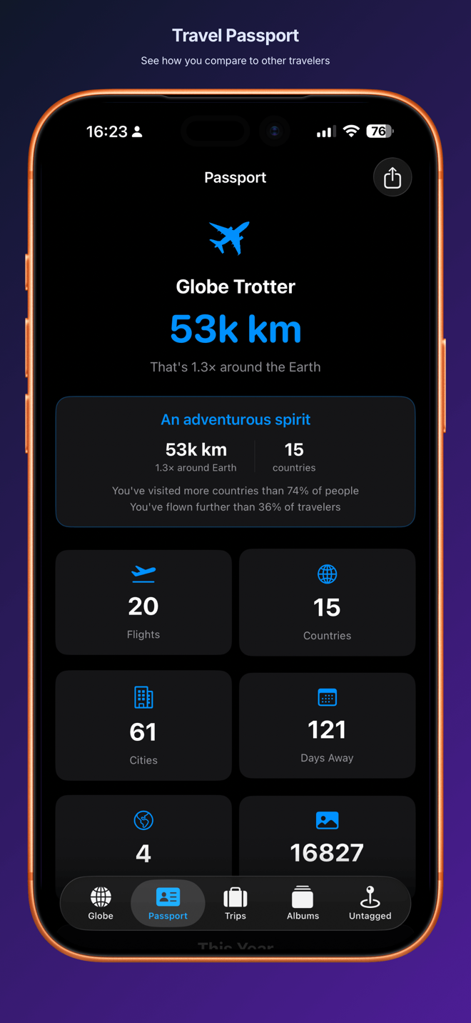
Travel Passport
Tracks flights taken, countries visited, cities explored, and total distance traveled — all from your photo library.
Trip Albums
Automatically groups your photos into trip albums by destination, with dates and locations attached.
Flight Log
Estimates flights between distant locations by analyzing timestamps and GPS jumps in your photos.
Manual Flight Entry
Add flights that your photos missed. Available in Pro to complete your travel history.
On-device Processing
All photo scanning and map building happens locally. No servers, no uploads, no accounts.
Privacy & Data
- No data collected — ever.
- Reads photo GPS metadata locally on your device.
- No network requests. Fully offline.
- No account required.
- All data stays on-device, encrypted by iOS.